History of Derry: A Walk Through the Walled City
Derry's history in brief, from the 1613-1618 walls and the 1689 siege to the Troubles and the Peace Bridge, with the surviving sites to walk between.
On this page
Derry is the only remaining completely walled city in Ireland, and one of the finest surviving examples of a walled city in Europe. That single fact gives a city break here its shape: almost everything worth seeing sits on or just inside roughly 1.5km of ramparts, with the Bogside murals and the river beyond them a few minutes' walk away.
What Derry's Walls Are and Why They Survive
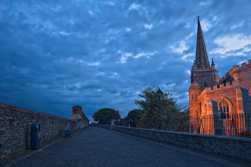
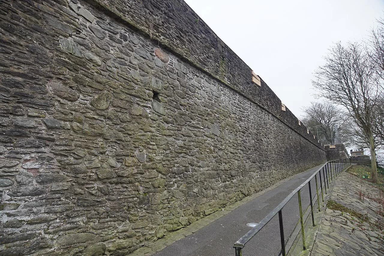
The Walls of Derry were built between 1613 and 1618 by the Irish Society as defences for early seventeenth-century settlers from England and Scotland. They form a continuous walkway around the inner city, about 1.5km in circumference, and they are the reason the centre still reads as a planned town rather than a sprawl.
Walking them takes you along ramparts that vary between 12 and 35 feet in width. That variation is not decorative: the wider stretches are the bastions, platforms built to carry artillery, which is why those sections feel like terraces rather than footpaths.
The height and completeness give you something rare in a UK city break: an elevated, traffic-free circuit from which you can look inwards at the street grid and outwards to the Foyle and the Bogside. Budget around an hour for a slow lap with stops; longer if you drop down at each gate.
Before the Walls: St Columba's Monastery
Derry was an established settlement for at least a thousand years before the ramparts went up, and its patron saint is Columba, the Irish monk who founded a Christian settlement here in the sixth century. The city's name derives from Daire, the oak grove associated with that early monastic site.
St Columb's Cathedral inside the walls is dedicated to him, and the present building dates from the seventeenth century rather than the monastic era. St Augustine's, known as the Wee Church on the Walls, is said to stand on the site of the sixth-century monastery, which makes it a useful stop when you want the earliest layer of the story rather than the Plantation one.
The Plantation and the Building of the Walls
The walls belong to the Plantation of Ulster, the early seventeenth-century scheme that brought English and Scottish settlers to this part of Ireland. The Irish Society built the defences as protection for those settlers, and the street plan inside the circuit still preserves its Renaissance grid, which was later copied in other Irish towns.
Look down from the ramparts and the naming is a guide to the original layout: Artillery Street where the guns were, Magazine Street where the powder was stored. It is the clearest way to read a seventeenth-century planned town without a map in your hand.
The Gates: Four Original, Three Added
The four original gates are Bishop's Gate, Ferryquay Gate, Butcher Gate and Shipquay Gate. Three more were added later: Magazine Gate, Castle Gate and New Gate. Each one connects the wall walk to a different part of the centre, so they work as exits rather than decoration.
A sensible circuit is to start at Shipquay Gate, close to the river and the Guildhall, and work clockwise past Castle Gate and Butcher Gate before finishing near Bishop's Gate. Butcher Gate puts you closest to the Bogside for the murals, while Bishop's Gate drops you by the cathedral quarter.
The Siege of Derry and the Cannon on the Walls
The city's defining episode is the Siege of Derry of 1689, when the people refused to open the gates to King James II for 105 days. The traveller account of the walls records that they were never breached during the siege, which is the claim the city's own story rests on rather than a point of military record.
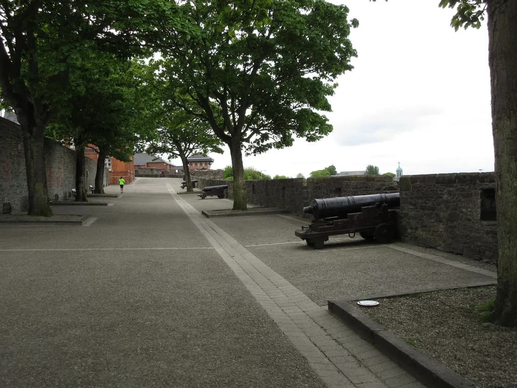
The city holds Europe's largest collection of cannon of precisely known origin, many of them fired during the two seventeenth-century sieges. Twenty-four surviving guns were restored in 2005, with conservators stripping paint and corrosion and treating the barrels by hand.
They stand along the walls rather than in a museum case, and the showpiece is Roaring Meg on the double bastion. Seek it out early in your lap, because it is the one object that makes the siege tangible instead of abstract.
St Columb's Cathedral and the Wee Church
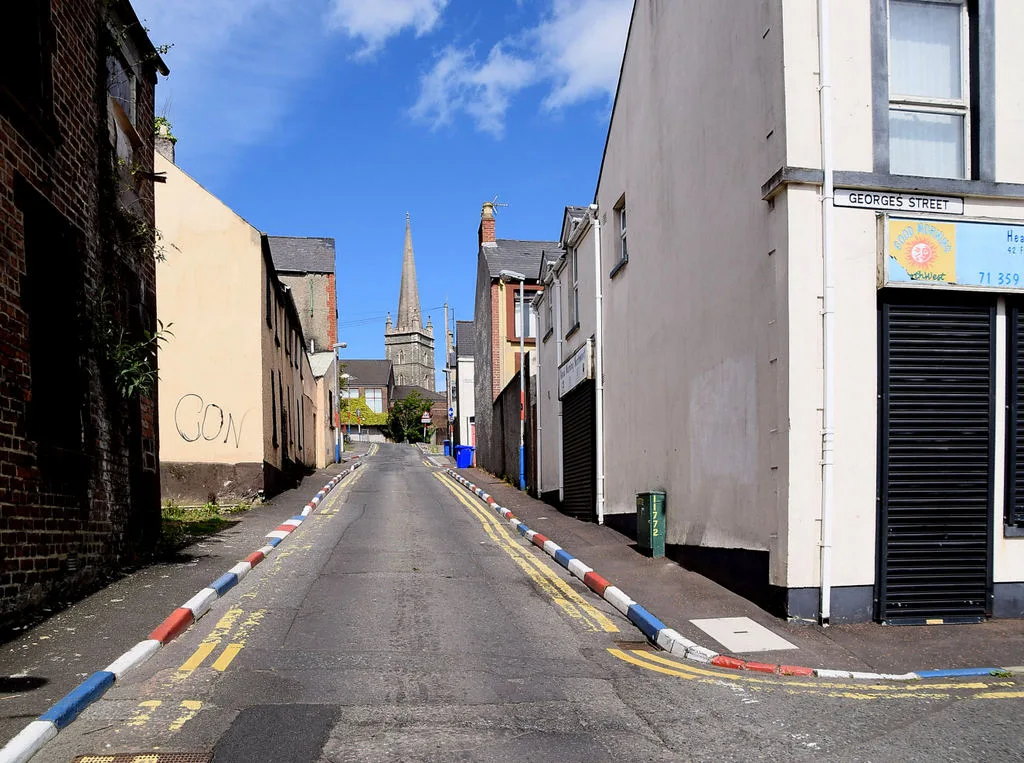
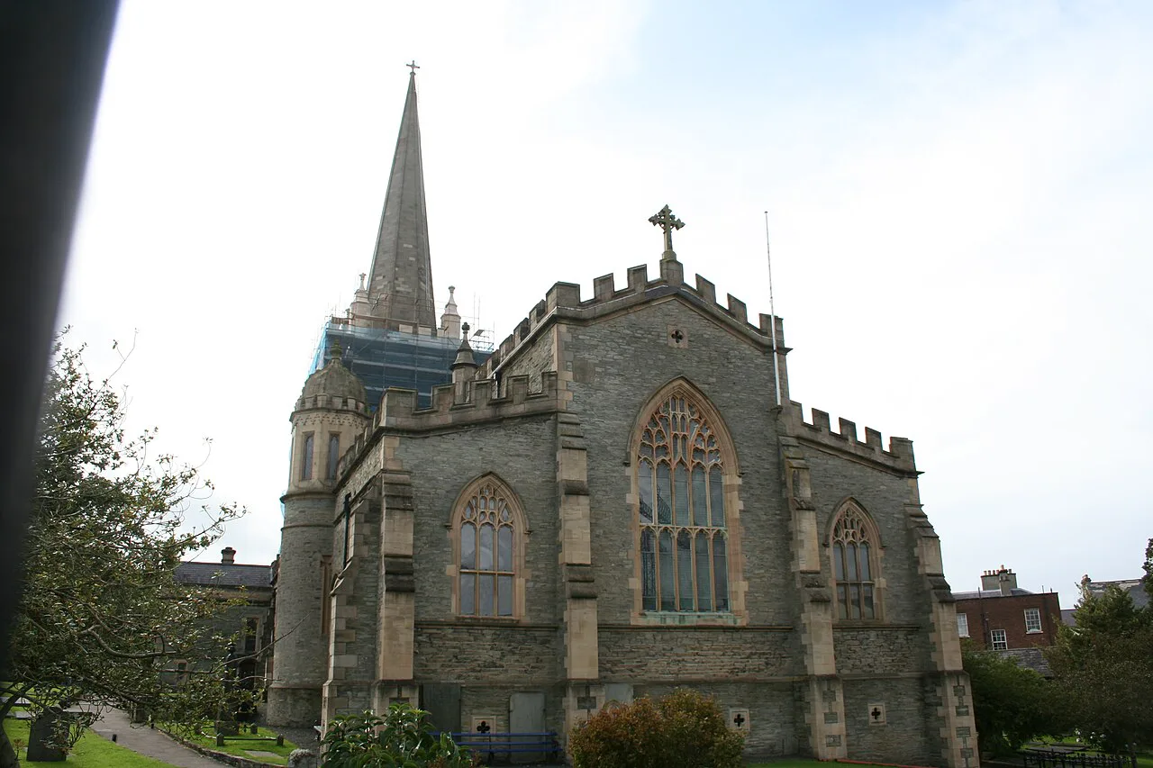
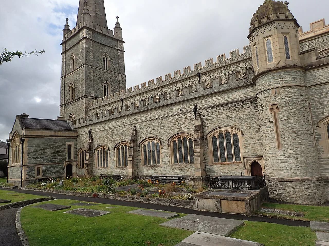
St Columb's Cathedral is the building most often framed from the ramparts, and its seventeenth-century fabric belongs to the same century as the walls themselves. Approach it on foot from Bishop's Gate, then continue to St Augustine's, the small church on the wall line known locally as the Wee Church on the Walls.
Both are working places of worship, so treat the interiors as a visit rather than a sight: go in if the doors are open, keep the circuit short, and give the cathedral quarter twenty minutes or so before rejoining the ramparts. Opening arrangements change with services, so confirm on the door or the cathedral's own notice before planning around it.
The Guildhall and the Site of the Market House
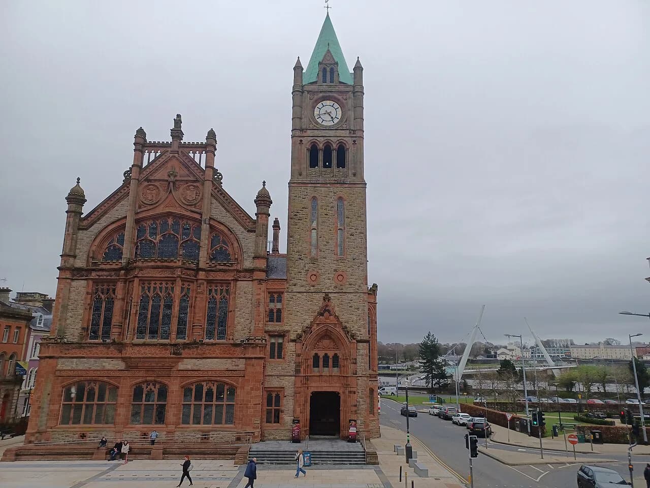
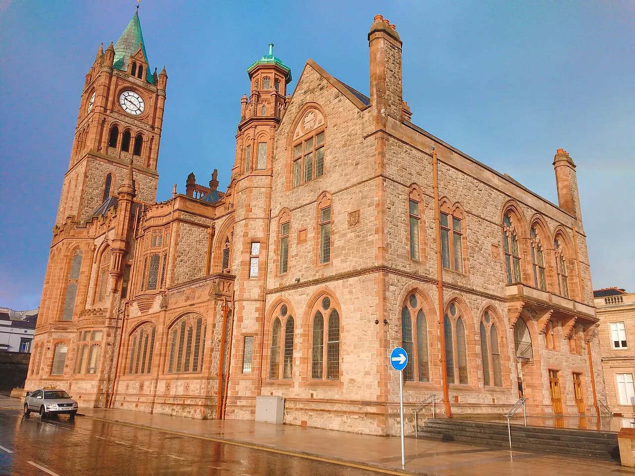
The seventeenth-century Market House was destroyed during the siege, and the red-brick Guildhall was built on the same site in 1890. It survived several attacks during the Troubles and is now open to visitors, which makes it the most concentrated piece of civic history inside the walls.
Inside, the main hall has a stage, a large organ and stained glass windows portraying the thirteen guilds that contributed to the building. Displays in the surrounding hall cover the Plantation and the Saville Inquiry into the events of Bloody Sunday, so a single stop carries you from the seventeenth century to recent memory.
From Walls to Conflict: the Bogside and Free Derry Corner
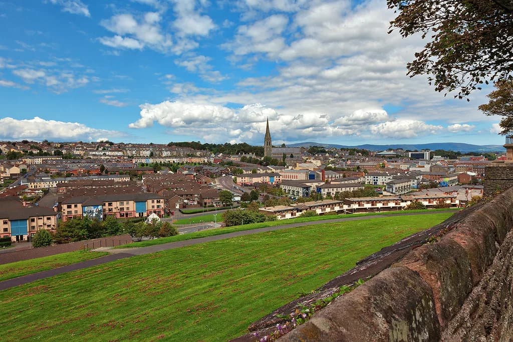
Look west from the ramparts and you are looking over the Bogside, the area below the walls where Free Derry Corner and the Troubles murals stand. The murals depict events of the Troubles and calls for peace, with plaques and monuments naming those killed in clashes and hunger strikes.
This is contested history, and the walk should be taken slowly and soberly rather than as a photo stop. Come down at Butcher Gate, walk the murals in sequence, and give the Bogside a clear hour of your day; it is the part of Derry that rewards the most attention and the least commentary.
If you want the museum layer of the same story, the museums in Derry cover the city's history and the Troubles in more depth than the street itself can. Pair a Bogside walk with an indoor collection when the weather turns, which it will.
The Peace Bridge and Modern Derry
The Peace Bridge is a pedestrian crossing over the Foyle, built in 2011 with backing from the European Union commissioner for Regional Policy. Its stated aim was to bridge the gap, literally and politically, between the mainly unionist west bank and the mainly nationalist east bank.
Walk it at the end of the circuit, when you have the Plantation and the Troubles behind you; the crossing takes minutes and gives the best view back to the walls from the water. It also links the walled centre with the rest of the city, so it works as a route rather than a detour.
The Craft Village: A Modern Recreation
The Craft Village inside the walls recreates an eighteenth-century street and a nineteenth-century square, and houses craft shops, coffee stops and balconied apartments. It is a modern piece of townscape, not a surviving historic quarter, so enjoy it for what it is: a pleasant pause with pedestrian streets and independent shops.
Set aside half an hour here between the cathedral and the Guildhall, and treat it as the breather in a day that is otherwise heavy on dates and conflict. If you are building an art-led afternoon instead, the art galleries in Derry make a natural next stop.
Practical Shape of the History Walk
Do the walls first thing, before the day's other business, because the circuit is exposed and the views are the point. Start at Shipquay Gate by the river, complete the lap past Roaring Meg and the cathedral, then drop into the Bogside at Butcher Gate and finish across the Peace Bridge.
For transport, the train from Belfast hugs the north coast and arrives in the city, which makes a car unnecessary for a walls-and-murals break. If you would rather have the dates and gates explained as you go, a guided Derry walking tour covers the same ground with context you will not get from plaques.
Expect a half day for walls, cathedral and Guildhall, and a full day if you add the Bogside, a museum and the bridge. Sunday is quiet in the Craft Village and many smaller sites keep short days, so front-load the sightseeing and leave the evening for pubs and live music.
Plan Your Visit
Derry's history is unusually easy to walk because the seventeenth-century defences still frame the centre: 1.5km of ramparts, seven gates and the cannon that survived two sieges. Build the day around that circuit, then step off it into the Bogside and across the Peace Bridge for the chapters that came later.
If you are comparing walled cities, the history of York offers a Roman and medieval contrast to Derry's Plantation grid. Closer in spirit, the history of Liverpool shows another port city rebuilt by conflict and trade, though its waterfront story runs along the River Mersey rather than a ring of ramparts.
Explore more Derry guides
Frequently Asked Questions
Are Derry's walls still complete, and can you walk the whole circuit?
Yes. The walls built between 1613 and 1618 survive as a continuous walkway around the inner city, roughly 1.5km in circumference, and you can walk the full lap on foot. They vary between 12 and 35 feet in width, with the wider stretches being the artillery bastions. Allow about an hour for a slow circuit with stops, and longer if you drop down at the gates to see the cathedral, the Guildhall or the Bogside.
Who built the Walls of Derry and when?
The Irish Society built them between 1613 and 1618 as defences for the English and Scottish settlers brought in during the Plantation of Ulster. The street grid inside the circuit still follows the original Renaissance plan, and the street names record what stood where, from Artillery Street to Magazine Street. Four gates were original, with Magazine Gate, Castle Gate and New Gate added later.
What happened during the Siege of Derry?
In 1689 the people of the city refused to open the gates to King James II for 105 days. The city's cannon, many of them fired during the two seventeenth-century sieges, are still displayed along the walls, and twenty-four of them were restored in 2005. Roaring Meg stands on the double bastion and is the piece to seek out first.
Where does the name Londonderry come from?
The city is known both as Derry and Londonderry, and the two names are used side by side today, often as Derry or Londonderry in the same sentence. Derry itself comes from Daire, the oak grove linked to St Columba's sixth-century monastic settlement. The naming carries political weight for both communities, so follow local usage and expect to see both on signs and stationery.
Why was the Peace Bridge built?
The Peace Bridge is a pedestrian crossing over the Foyle, completed in 2011 with backing from the European Union commissioner for Regional Policy. Its purpose was to connect the mainly unionist west bank with the mainly nationalist east bank, both physically and symbolically. Walking it at the end of a walls circuit takes minutes and gives you the best view back to the ramparts from the river.
Sources
Notes for your next city break
Optional updates to our UK city guides.
You might also like
Continue reading
More guides you'll find useful