
Western Heights Dover: A Visitor's Guide to the Fortifications

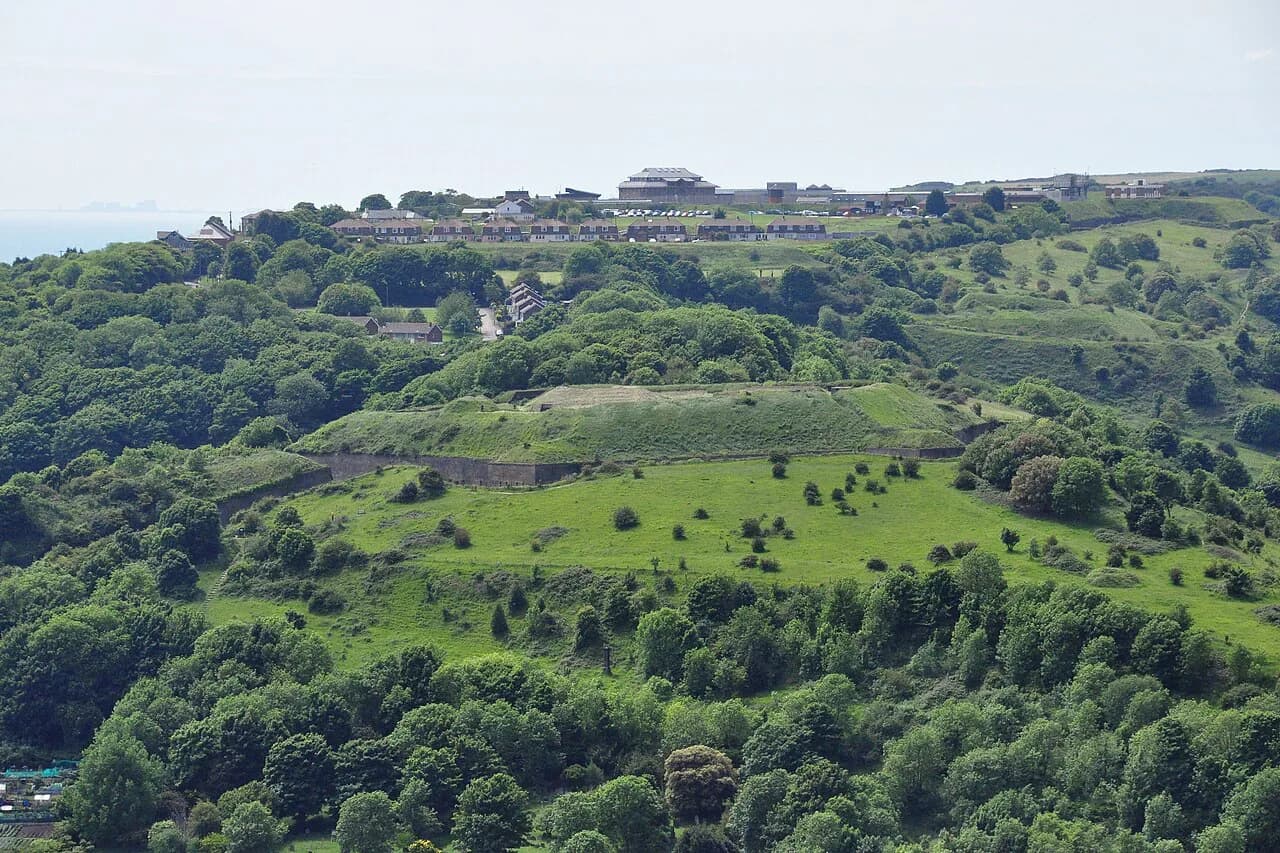
Western Heights Dover is a large fortress complex on the high chalk ground west of Dover town centre, built in two main phases between 1804 and 1816 and again between 1858 and 1867. Historic England lists the site as a Scheduled Monument covering the fortifications, a Roman lighthouse and a medieval chapel, so a visit is about reading earthworks and fort perimeters rather than touring a furnished museum. Allow half a day if you want to walk the main lines properly.
This guide sticks to one place: what the Heights are, why they were built, how to get up there from the station or the docks, and what to combine with the walk. Practical arrangements change, so check current access details with the White Cliffs Country Visitor Information Centre before setting out.
What Western Heights Is
The Western Heights are a fortified plateau above Dover, designed to command the town, the harbour and the approaches from the sea. Historic England's designation covers the fortifications together with a Roman lighthouse and a medieval chapel inside the scheduled area, which makes this a layered landscape rather than a single building.
Treat the site as open clifftop ground with historic structures rather than a ticketed attraction with a shop and café. That shapes everything about the visit: you walk between features, you read the ground, and you bring your own water and weather protection.
Dover as a whole rewards a couple of days, and the Heights work best as one substantial element of a wider stay. Start with the Dover Attractions: 8 Visitor Guides overview to see how castles, museums and clifftop walks fit together before you commit your time.
Why the Fortress Was Built
The Napoleonic Wars, which ran from 1793 to 1815, drove the construction of the large fortress on the Western Heights. Dover sat directly opposite the French coast, and the high ground behind the town offered the natural place to hold it against invasion and to cover the port below.
Understanding that threat explains the layout you walk through. Defences face outward and inland, ditches cut deep into the chalk, and sightlines are deliberately long. Keep that in mind and the seemingly scattered earthworks start to make sense as one defensive system.
The Two Building Phases
The fortress was built in two main phases, 1804 to 1816 and 1858 to 1867. The first phase answered the Napoleonic threat; the second reflects the mid-Victorian fear of invasion that produced forts along the south coast.
Within the wider fortress the report identifies three powerful independent forts and redoubts, which is the key to reading the site. You are not looking at one continuous wall but at separate strongpoints built to support each other.
That matters practically: walking from one fort to the next involves real distance over sloping chalk ground. Plan your route around the strongpoints you most want to see rather than trying to cover everything in one push.
The Roman Lighthouse and Medieval Chapel
The scheduled area includes a Roman lighthouse and a medieval chapel as well as the fortifications. Pharos towers of this kind once guided shipping along the Channel approaches, and Dover's is part of the town's much longer story of watching the water.
These structures sit inside the monument rather than as a separate excursion, so fold them into your walk. They are also a useful reminder that the Heights were used and reused for well over a thousand years before the gun emplacements arrived.
Another surviving Roman structure in the town, the Roman Painted House, gives the Roman side of Dover in more concentrated form. It works well as a second, shorter stop on the same day.

What to See on a Visit
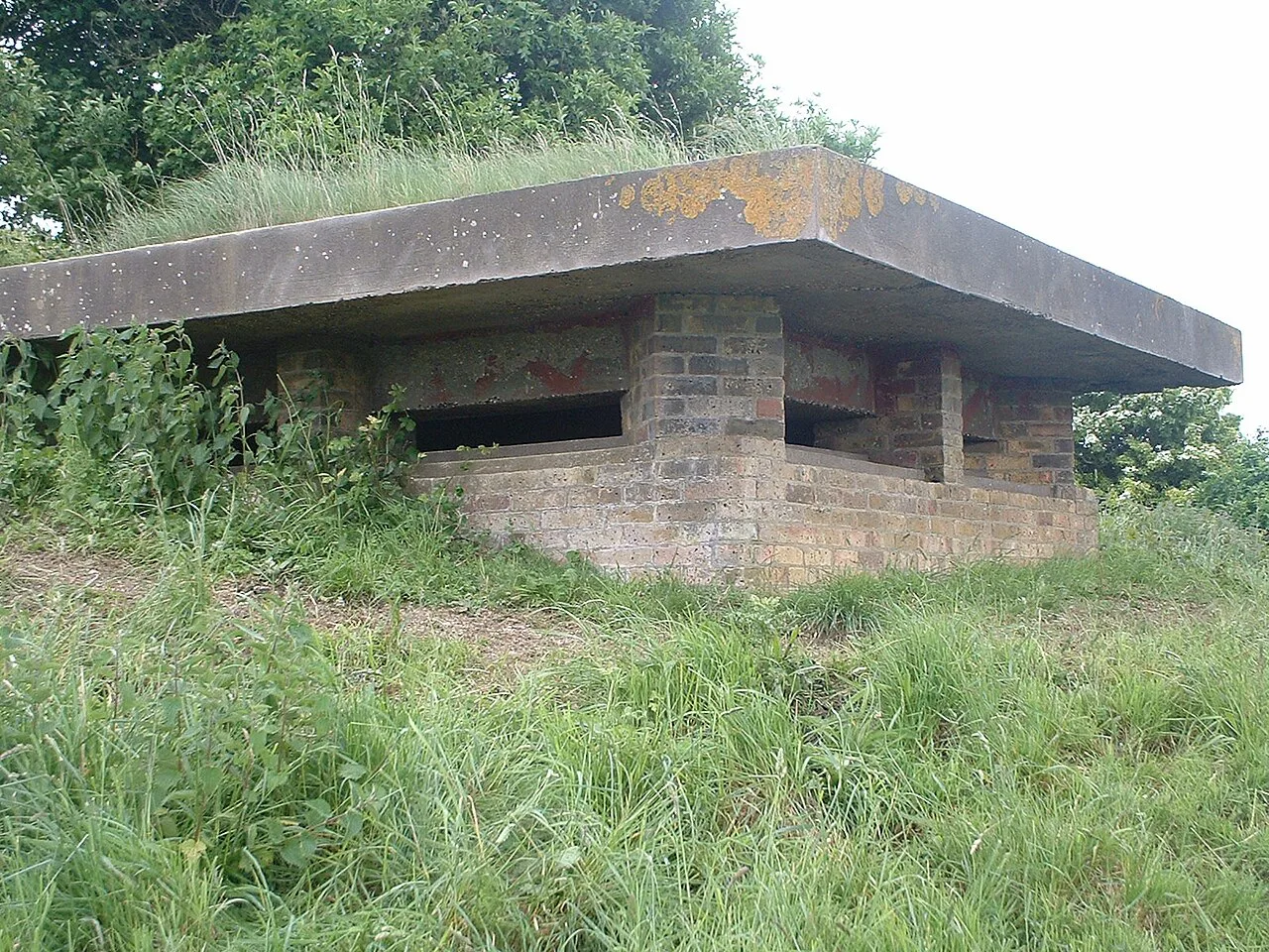
Expect earthworks, ditches, fort perimeters and long clifftop views over Dover and across the Channel. The appeal is topographic as much as architectural: you see why this ground mattered by standing on it and looking down at the harbour and the town.
Bring binoculars if you have them. Shipping traffic entering and leaving the Port of Dover gives the clifftop edges constant movement, and it is one of the reasons the plateau repays a slow walk rather than a quick circuit.
Vegetation and weathering vary through the year, so the amount of structural detail visible from the paths changes too. Late autumn and winter walks expose more of the earthworks; summer growth obscures some of the lower lines.
Getting There from the Station and the Docks
Dover Priory is the nearest station to the ferry terminals, just over a mile away, and high-speed services reach London in just over an hour. Walking from the station to the Passenger Terminal takes about 25 minutes, and taxis wait at both the terminal and the station if you would rather ride than walk.
The Western Heights sit on the plateau above the town, so any approach from the centre or the waterfront involves a climb. Build that ascent into your timing, and consider starting the day with it while you are fresh rather than after hours on your feet.
If you are arriving by car, the M20 and A20 bring you to the Eastern Docks roundabout, and Dover is roughly 70 miles from London. Park in town and walk up rather than hunting for space on the plateau.
How Long to Allow and What to Wear
Half a day is a sensible allowance if you want to see more than one fort and take in the viewpoints. A shorter outing of an hour or two covers the nearest strongpoint and the main panorama without a rushed return.
Wear sturdy footwear with grip. The ground is uneven, often steep and exposed, and chalk paths become slippery after rain; trainers with smooth soles are a poor choice here.
Layer up and carry waterproofs, because the plateau is windier and wetter than the town below even when the seafront feels mild. Water and a snack matter as much as the jacket, since facilities on the high ground are limited.
Tickets, Opening Arrangements and Access
The monument is designated as a Scheduled Monument, which tells you a great deal about its protection but not about visitor arrangements on any given day. Check current access before travelling, particularly if you are making a special trip or have mobility needs.
Dover's tourist information centre sits in Dover Museum on Market Square and can advise on the town's sites and events. You will also find practical town information, including accommodation and what is on, through the local tourism pages.
If hill walking is off the cards, Dover's flatter attractions still give you the history: the town museum holds the Bronze Age Boat, described as the world's oldest known sea-going vessel. That makes a good wet-weather or low-mobility substitute for the Heights.

Honest Trade-offs
This is open ground, not a managed visitor attraction, so expect no ticket desk, no café and no interpretation centre at the fortifications themselves. The reward is atmosphere and scale; the cost is self-sufficiency.
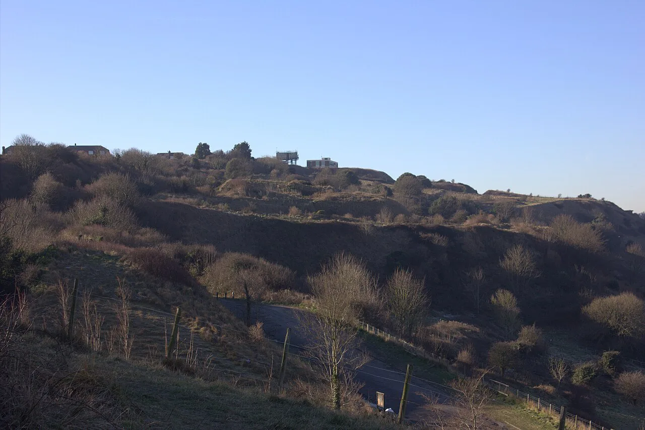
The terrain is the real test. Slopes, rough chalk, exposed edges and long stretches between features mean the Heights suit confident walkers better than casual strollers.
Time your visit for clear weather if the views are the point. On a grey day the clifftop can be bleak and the panorama disappears, and you will get more from Dover Castle or the town museums instead.
Nearby Sights Worth Combining
Dover Castle sits on the White Cliffs above the port and packs in the Great Tower, the Secret Wartime Tunnels and the Underground Hospital. The Visit South East England listings put the castle about 0.44 miles from the town centre reference point, which makes it an easy pairing with a Heights walk.
The White Cliffs of Dover walk runs along the clifftop toward South Foreland Lighthouse at St Margaret's Bay, and Fan Bay Deep Shelter offers guided tours of Second World War tunnels in the same area. The listings give Fan Bay Deep Shelter as about 1.26 miles from the town reference and the White Cliffs at about 1.23 miles.
In town, the Maison Dieu is an 800-year-old building that once sheltered pilgrims bound for Becket's shrine at Canterbury, and it has reopened after a multimillion-pound restoration. The visit listings give it as roughly 0.28 miles from the town centre. If that pilgrim connection tempts you onward, our Canterbury guide covers things to do in Canterbury around the cathedral.
Dover's museums fill out a longer stay, including the Dover Museum and Bronze Age Boat Gallery and the Dover Transport Museum. The listings place Dover Museum at 0 miles from the town reference, so it makes a sensible first stop for orientation.
Plan Your Visit
Give the Western Heights at least half a day, start early enough to climb the hill while fresh, and wear boots that cope with chalk and slope. Pair the walk with Dover Castle or the White Cliffs if you want a full day of clifftop history, or drop to the town museums when the weather turns.
Confirm access arrangements with the visitor information centre in Dover Museum on Market Square before a special trip. That one call settles the practical questions the monument designation cannot answer.
Explore more Dover guides
Frequently Asked Questions
What is Western Heights in Dover?
It is a large fortress complex on the high ground above Dover, designated a Scheduled Monument that includes the fortifications, a Roman lighthouse and a medieval chapel. You visit it as open clifftop ground with historic structures rather than as a ticketed attraction with facilities.
When were the Western Heights fortifications built?
They were built in two main phases, 1804 to 1816 and 1858 to 1867. Within the wider fortress the fortifications comprise three powerful independent forts and redoubts rather than one continuous wall.
Why were the Western Heights built?
The Napoleonic Wars, which ran from 1793 to 1815, prompted the building of the large fortress on the Western Heights. Dover faces the French coast, so the high ground behind the town was the natural place to hold it and cover the port below.
Can you walk around Western Heights for free?
No source gives a price or a paid arrangement for the Heights, so admission is something to ask about locally. Dover's visitor information centre in Dover Museum on Market Square can tell you about current access.
How long does it take to visit Western Heights?
Allow half a day to see more than one fort and take in the viewpoints, or an hour or two for the nearest strongpoint and the main panorama. The walking between strongpoints is over sloping chalk ground, so factor in the climb from town.
How do you get to Western Heights from Dover town centre?
The site sits on the plateau above the town, so any approach from the centre or waterfront involves a climb. Dover Priory station is just over a mile from the ferry terminals, with a walk of about 25 minutes from the station to the Passenger Terminal and taxis at both.
What is there to see near Western Heights?
Dover Castle is about 0.44 miles from the town centre reference, the White Cliffs and Fan Bay Deep Shelter about 1.23 and 1.26 miles, and the Maison Dieu about 0.28 miles. Dover Museum and the Roman Painted House cover the town's Roman and maritime history.