Medieval Canterbury Guide: What to See in the Historic City
See medieval Canterbury on foot: Roman walls, the Dane John Mound, Becket's shrine and the city's oldest streets, with the history behind each stop.
On this page
Medieval Canterbury reads best as a circuit rather than a checklist. The Roman wall line became the medieval wall and still bounds the centre, so the shape of the old town is the shape of your walk. The surviving gate, the Dane John Mound, the cathedral precinct and the sites of the friaries all sit within or just outside that boundary, which makes a single day enough for the main stops.
What medieval Canterbury is and why the layout still shows it
Canterbury grew as Durovernum Cantiacorum, the Roman town whose street grid was laid out in the early second century, and the medieval city inherited that frame. In the late third century the town was enclosed by a wall, rampart and ditch, and the trust that excavated the city notes that the Roman walls became the medieval walls. That is why the historic core feels compact: you are walking inside a boundary drawn more than 1,600 years ago and renewed in stone in the 14th century.
The bigger picture rewards a little preparation. For a wider chronology that puts the medieval city in context, the history of Canterbury runs from the Iron Age forerunners through to the bombing of the Second World War, which destroyed or seriously damaged more than 1,000 buildings. Knowing that helps you read the gaps in the street frontage, where post-war rebuilding replaced medieval fabric.
Start at Westgate: the one surviving city gate
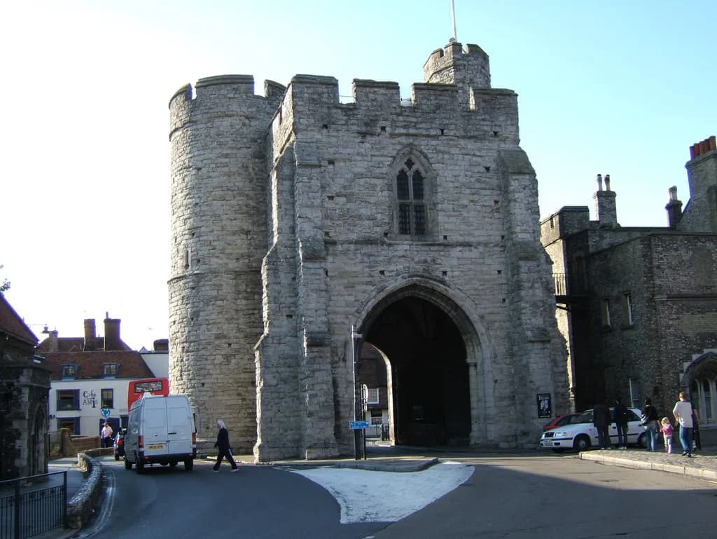
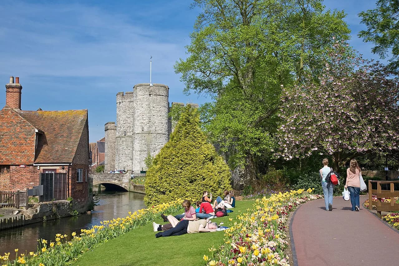
Begin at Westgate, the only one of Canterbury's city gates left standing. The others were demolished in the late 18th century to ease traffic flow, so this is the single place where you can walk through the medieval entrance to the city rather than past its ghost. Treat it as the start line for the walk and orient yourself from there: the wall runs away on either side and the cathedral lies to the east.
The city walls: Roman origin, medieval rebuilding, and where you can still trace them
The wall you can follow today is a palimpsest: a Roman defensive circuit, extensively remodelled, then rebuilt during the Hundred Years' War as a statement of the city's importance and prosperity. For a comparison with another complete circuit, medieval Chester keeps a fuller ring of walls, and walking both makes the Canterbury fragments easier to interpret. The line itself is the point here, more than any single stretch of masonry.
The medieval gates have left their names in the street pattern even where the stone has gone. Worthgate, Ridingate and Newingate anchored the roads into the city, and the mid-to-late Anglo-Saxon town was focused on the axis from Worthgate to the cathedral. Look for these names on street signs and you are tracing the old entrances without needing a map in your hand.
Dane John Mound and the Norman motte-and-bailey castle
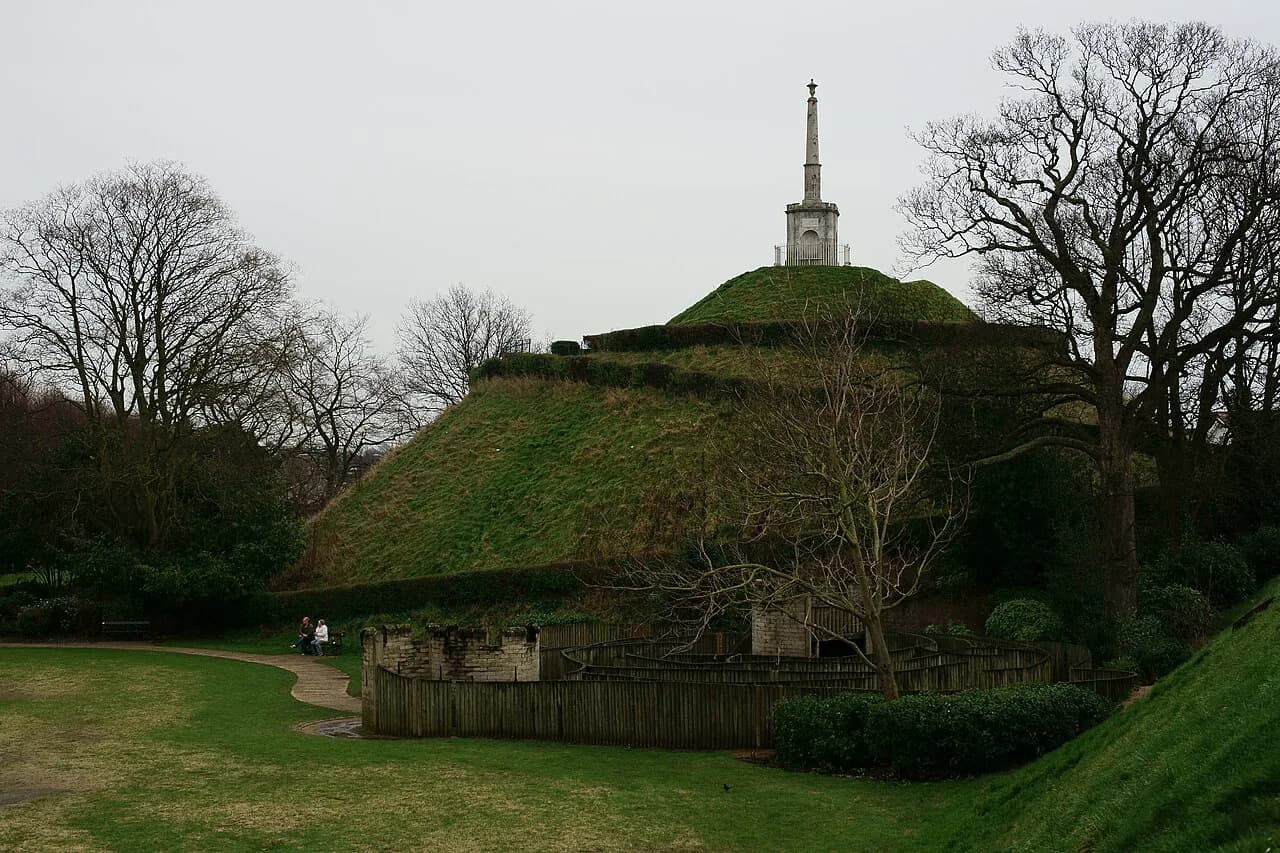
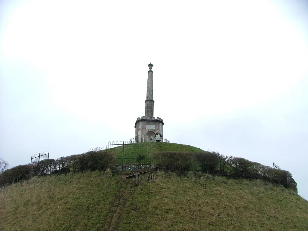
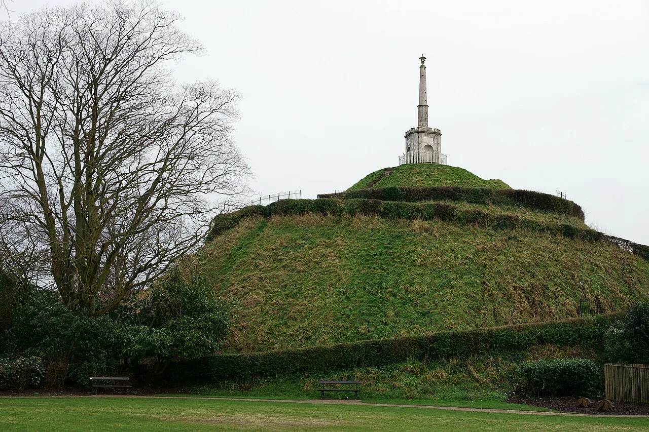
After the Norman Conquest of 1066 a motte-and-bailey castle was thrown up, and its mound survives as the Dane John, now a landscaped garden rather than a ruin. Read it as earthwork evidence: the shape tells you where the Norman garrison sat in relation to the old Roman enclosure. A new royal castle was built next to Worthgate by the early 12th century, but it was only sporadically occupied and was mainly used from the early 13th century as a centre of royal government.
The castle site is a fragment rather than a visitable keep in the full sense: it was in a state of disrepair in the 18th century and most parts were demolished. Set your expectations accordingly and use the mound and the remaining masonry as markers of the Norman presence rather than as a castle day out. If you want a fuller castle experience, castles near Canterbury are worth a separate trip.
Canterbury Cathedral: Becket's murder in 1170 and the shrine that made the city a pilgrimage centre
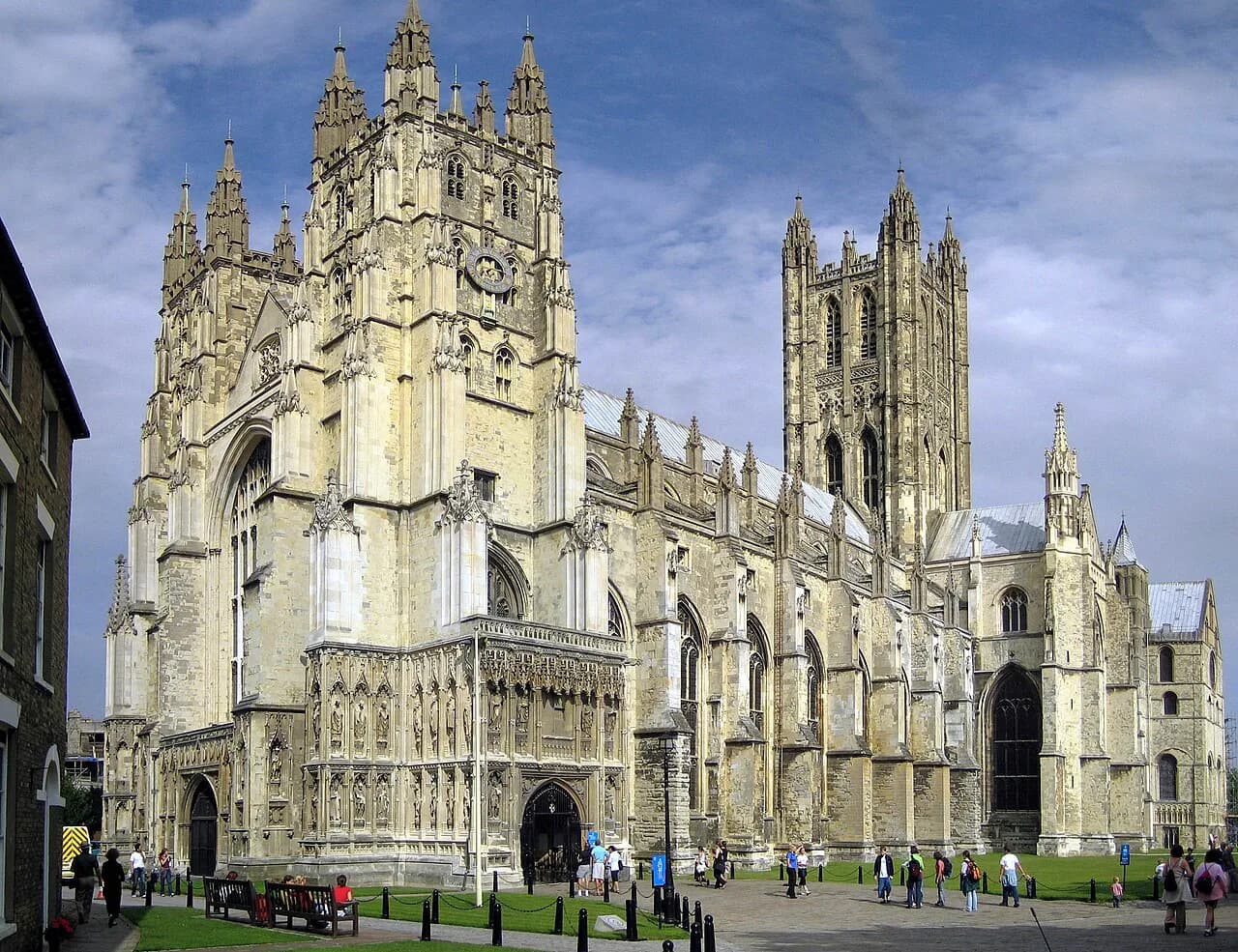
Archbishop Thomas Becket was murdered in the cathedral on 29 December 1170, and in 1220 his remains were translated to a new shrine in the Trinity Chapel. That translation changed the city's fortunes: Canterbury became a centre of international pilgrimage, and the gifts of pilgrims were channelled by archbishops, abbots and priors into the cathedral and abbeys. The shrine economy is the reason so much ecclesiastical building followed.
For the architecture that the pilgrim income paid for, the cathedral repays slow looking rather than a quick circuit, and the wider story of Canterbury architecture helps you place what you see in date order. Check the cathedral's own site for opening times and tickets before you travel. Allow the largest single block of your day for this stop.
The cathedral precinct: Roman streets beneath it and Lanfranc's rebuilt cathedral and palace
The precinct is layered ground. Archaeological evidence shows two Roman-period streets beneath the cathedral, and the area around the later cathedral may have held a residential quarter of the Roman town. Lanfranc, the first Norman archbishop, built a new cathedral and cloister with an adjoining palace, moving the precinct boundary westwards to what is now Palace Street. Walk Palace Street and you are following a line redrawn in the 1070s.
If the cathedral is busy, use the precinct edges as your breathing space. The streets around Palace Street and the old burh boundary let you trace the monastic enclosure without standing in a queue, and they explain why the cathedral close feels like a separate town within the city. That separation is medieval in origin, not a modern planning decision.
St Augustine's Abbey and the other ecclesiastical foundations around the walls
East of the walls, St Augustine's Abbey grew from the mission sent by Pope Gregory the Great, which arrived in 597 and converted King Æthelberht. The abbey was rededicated in 978 and competed with other foundations for land and income. It is now an open ruin: the church was levelled at the Dissolution, so what you see is foundations and surviving buildings rather than a roofed abbey.
This eastern group also includes St Martin's Church, a short walk beyond the walls, and the line of churches that ran from the cathedral to St Martin's. The abbey, the cathedral and St Martin's together underpin Canterbury's UNESCO World Heritage status. Check opening arrangements for the abbey and the church with the bodies that run them before setting out, as a ruin and a working church keep different rhythms.
The friaries and hospitals: Greyfriars, Blackfriars, Whitefriars and Eastbridge
The mendicant orders arrived in the 13th century and settled on the banks of the Stour: the Franciscans, known as the Greyfriars, in 1224 and the Dominicans, the Blackfriars, in 1236. The Augustinian Whitefriars came later, around 1320, inside the wall near St George's Gate. These dates matter because they show how quickly the medieval city acquired a full set of religious institutions beyond the cathedral and the abbey.
Hospitals completed the picture. Eastbridge, the Poor Priests' Hospital and Maynard and Cotton's Hospitals were charitable foundations serving pilgrims, the poor and the clergy. Most survive as fragments, names or later buildings, so read them as traces in the street rather than as attractions with a door and a desk. The value is in noticing how much of the medieval city was devoted to shelter and care.
The medieval street pattern: High Street, Burgate Street and the shopping centre that endures
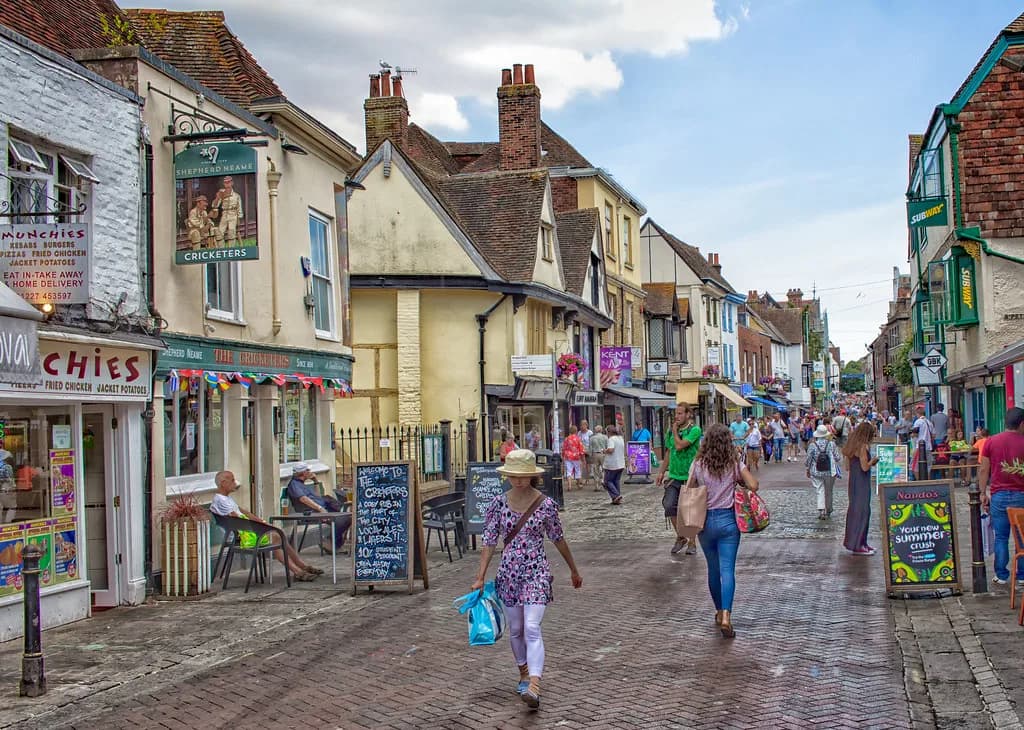
The 12th century saw expansion along new commercial roads south of Burgate Street, linking to what became the High Street, which has remained a shopping centre ever since. That continuity is unusual and easy to miss while you are looking in shop windows: the retail geography of the city was set in the medieval period and has barely moved. Walk the High Street as a medieval street that happens to be full of modern shops.
Markets fixed other streets in place. A wagon market at Wincheap outside Worthgate and a cattle market outside Newingate probably date to the Anglo-Saxon period, which explains why those roads feel like approach routes rather than shopping streets. If you want company and commentary while you walk, a guided Canterbury walking tour covers the same ground with a guide's framing.
The River Stour, King's Bridge and the royal exchange area
In the medieval city, Christians, Jews and moneyers lived side by side around the King's Bridge and the mill on the River Stour, where the royal exchange stood. That is a more mixed picture than the cathedral-dominated story usually told, and it is worth pausing on the river to take it in. The Stour also powered mills and carried trade, so the water was working infrastructure rather than scenery.
The medieval river frontage is now largely built over or channelled, so expect glimpses rather than a preserved waterfront. Use the bridges as viewpoints and pair the river walk with the friary sites, which cluster on the same banks. It is a short detour that adds the commercial and minority history that the cathedral precinct cannot supply.
What the Dissolution and later centuries removed
The Dissolution of the 1530s closed the city's priory, its nunnery and three friaries, along with St Augustine's Abbey, whose church was levelled and parts of whose buildings became a palace for Henry VIII. Pilgrim income was cut off at the same time, and the city's economy had to change. This is the single event that explains why Canterbury's medieval heritage is fragmentary rather than intact.
Later centuries continued the work. Refugee Huguenots brought silk weaving in the 17th century, the castle was largely demolished in the 18th, and the city gates followed. Post-war road building and development changed the townscape further. What remains is a medieval skeleton wearing later clothes, which is why a guide to the medieval city is really a guide to reading layers.
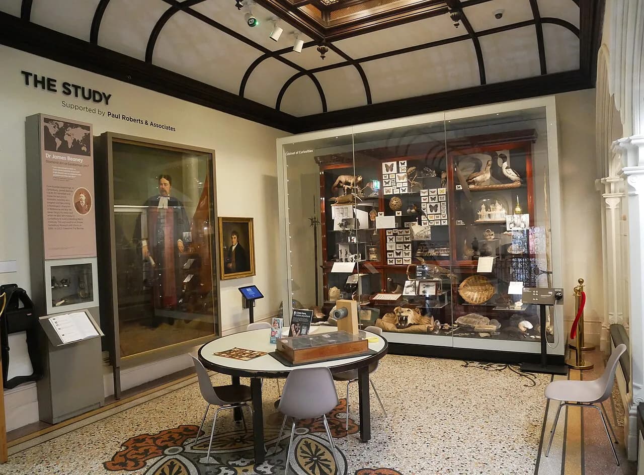
If the medieval material leaves you wanting more, museums in Canterbury hold collections that fill in the gaps, and the twentieth-century and later art holdings sit alongside the archaeological story. Build a wet-weather contingency around them, since a museum visit is the natural substitute for a washed-out walk.
Practical route: order of stops, walking times and where to break for tea
A sensible order is Westgate, the wall line to the Dane John Mound, the cathedral precinct and Palace Street, then east to St Augustine's Abbey and St Martin's, doubling back along the High Street with a detour to the Stour and the friary sites. The whole circuit sits within a compact centre, and the stops are close enough that the walking time is modest compared with the time you will spend at the cathedral and the abbey.
Break the day in the middle rather than at the end, because the eastern stops involve the most ground outside the walls. Afternoon tea is the obvious pause and Canterbury has plenty of choice, but book ahead for the well-known rooms, especially at weekends. Two further stops suit different tastes: art galleries for a quieter indoor hour, and ghost tours in Canterbury for an evening of legends told as legends.
Give the cathedral the largest single block and keep the rest flexible. If time is short, cut the eastern excursion to St Augustine's Abbey and St Martin's rather than rushing the precinct, since the abbey is a ruin that rewards unhurried reading. Check current opening arrangements for the cathedral, the abbey and the churches before you set out.
Books and maps that help: the Historical Map of Canterbury and the Twenty Centuries portal
Canterbury Archaeological Trust, working with the Historic Towns Trust and Canterbury Christ Church University, has published an illustrated fold-out Historical Map of Canterbury from Roman Times to 1907, usable as a self-guided tour with an introduction and gazetteer. The trust's own page lists it at £9.99, with proceeds after printing costs funding further work. It is the single most useful thing to buy before you walk.
The free option is the Twenty Centuries at Canterbury online portal, an interactive map of the city's archaeology and history: pick a location and a century, and you get detail on the site. For a broader reading list, Medieval & Early Modern Canterbury & Kent collects freely available sources covering the period from 597 to 1597, including the Becket Story 3D reconstructions of medieval Canterbury and the cathedral.
For serious reading, Kent's archive at Maidstone holds the largest collection of documents relating to the county, and the cathedral archives and library are the place to start on ecclesiastical records. These are research resources rather than visitor attractions, so plan them for a separate day. They are also the honest answer to the question of how much of medieval Canterbury is gone.
Plan Your Visit
Book the cathedral first and let everything else fit around it. The walk works best as a full day with a sit-down break in the middle, and it does not require a car: every stop in this route sits within or just outside the old wall line. Build in slack for the abbey, which takes longer than its ruined state suggests.
For a change of register, compare Canterbury with medieval Nottingham, where a castle rather than a cathedral shaped the town. The contrast makes the pilgrimage economy of Canterbury look as distinctive as it was.
Explore more Canterbury guides
Frequently Asked Questions
What medieval sites can you still see in Canterbury?
Westgate is the only surviving city gate, and the Dane John Mound remains as the earthwork of the post-1066 motte-and-bailey castle. The cathedral precinct, St Augustine's Abbey as a ruin, St Martin's Church, the wall line, the medieval street pattern of the High Street and Burgate Street, and fragments of the friaries and hospitals are the main stops. Most are within or just outside the old walled centre.
Was Canterbury important in medieval times?
Yes. The murder of Archbishop Thomas Becket in the cathedral on 29 December 1170 and the translation of his remains to the Trinity Chapel in 1220 made the city a centre of international pilgrimage. Pilgrim gifts and ecclesiastical income paid for building across the cathedral and the abbeys, and its position as the centre of the English church dates from Augustine's mission of 597.
Why did pilgrims go to Canterbury?
Pilgrims came for the shrine of Thomas Becket, murdered in the cathedral in 1170 and translated to the Trinity Chapel in 1220. The pilgrimage traffic supported hospitals such as Eastbridge and the Poor Priests' Hospital, and its income was channelled by archbishops, abbots and priors into the cathedral and abbeys. The Dissolution of the 1530s cut that income off.
What did the Romans call Canterbury?
The Roman town was Durovernum Cantiacorum, the administrative centre of the groups the Romans called the Cantiaci. Its street grid was laid out in the early second century and the town was enclosed by a wall, rampart and ditch in the late third century. Those Roman walls later became the medieval walls of Canterbury.
How long does it take to walk medieval Canterbury?
Allow a full day for the circuit from Westgate through the cathedral precinct to St Augustine's Abbey and back along the High Street, with the cathedral taking the largest single block. The stops are close together, so the walking time is small compared with the time spent at each site. A shorter half-day version works if you skip the eastern excursion.
What happened to Canterbury's abbeys after the Dissolution?
The Dissolution of the 1530s closed the city's priory, its nunnery and three friaries along with St Augustine's Abbey, whose church was levelled and some of whose buildings became a palace for Henry VIII. Pilgrim income stopped at the same time. This is why the abbey survives as foundations and standing fragments rather than a roofed complex.
Where can I get a map of medieval Canterbury?
Canterbury Archaeological Trust, with the Historic Towns Trust and Canterbury Christ Church University, publishes An Historical Map of Canterbury from Roman Times to 1907, an illustrated fold-out map with an introduction and gazetteer designed for self-guided touring. The same partnership runs the free Twenty Centuries at Canterbury online portal, where you can pick a location and a century.
Is there a guided walk covering the medieval city?
Guided walking tours of Canterbury cover the medieval streets and the cathedral area with a guide's commentary, which suits anyone who wants the chronology explained on the spot. Self-guided options are the Historical Map of Canterbury and the Twenty Centuries portal. For the cathedral itself, check its own published arrangements before travelling, as these vary through the year.
Sources
Notes for your next city break
Optional updates to our UK city guides.
You might also like
Continue reading
More guides you'll find useful